Castle Pass to Manning Park, Canada

Castle Pass to Manning Park, Canada

August 16, 2015
Day 16: Castle Pass to Manning Park, Canada
Miles: 12.48
Total Miles: 2,660
Miles to Go: 0

We ate breakfast with Littlefeet, but it was hard to stay present. We were all too excited. Only four short miles stood between us and Canada. Big breath.

It was still foggy, but it was shaping up to be a nice day and truth be told, we didn’t care. It could have been snowing, the forest could have been burning down around us, and we wouldn’t have cared. You could walk through anything for four miles if you had to. We were going to make it to Canada!

Littlefeet was the first one out of camp, but we were not that far behind him. Krav took off and was gone like the wind.

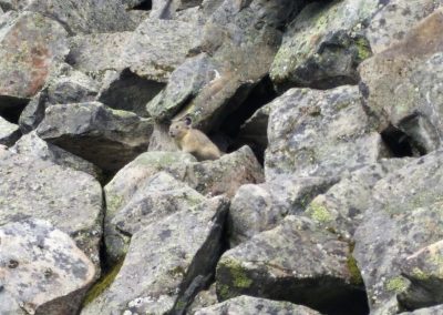
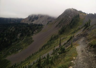
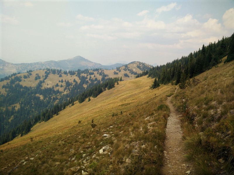
I can’t tell you what the trail looks like between Castle Pass and Canada – a blur of green I suppose. I did see a ptarmigan, but the photo I took was blurry because I didn’t care enough to stop and take a proper photo.

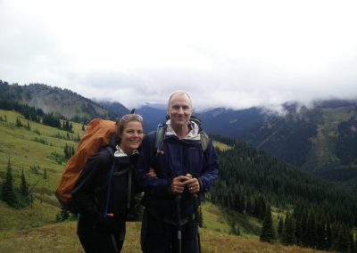
We were half a mile from Canada when we came across Krav. He wanted the three of us to get to the monument together, and so he had been waiting.

Elbows out, we joking raced each other to the finish to see who would “get there first,” pretending to trip each other along the way. Krappypants was in the lead.

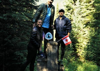
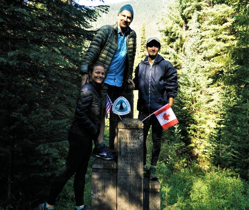
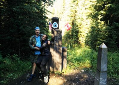
And then, just like that, the trees parted, and there it was – the northern terminus of the Pacific Crest Trail. Five wooden pillars of various heights stood next to a metal pillar in the middle of a twenty foot wide clear-cut that stretch as far as the eye could see in either direction.

On the tallest of the wooden posts, the familiar crest of the Pacific Crest Trail greeted us like an old friend. We had faithfully followed this symbol all the way from Mexico; although it hadn’t always been easy, it had never once led us astray. On the next lower pillar, the U.S. and the Canadian flags waved in the early morning breeze. The sun came out, the birds sang in greeting. All was finally right in our world.

Littlefeet had arrived a few minutes before us, giving him a chance to reflect and to write in the log book about his incredible 2,660-mile thru-hike.

We celebrated together, snapping pictures and pulling out the four mini bottles of champagne we had carried from Rainey Pass. The fourth bottle had been for Bearcat, but now that we were there with Littlefeet, we couldn’t very well cheers without him!

Littlefeet filmed, while we made Bearcat a video, pouring some of our champagne out in honor of our fourth Musketeer. Afterwards, we toasted our success.

The logbook made its rounds, from Krav to Bearclaw, and finally to me. What to write? How do I adequately describe something that has changed me so profoundly? What words of thanks could ever express how deeply grateful I was for this trail and the lessons it had taught me? How could I summarize something that was so profound it was impossible for me to even fully comprehend?

I read Krav and Bearclaw’s entries.

8/16/15 After being snow out in 2013, I am finally done! Here before Hummingfart! Yaas! Now, what to do? – Krav Maga …In memory of Bearcat, who couldn’t be here, “Efficiency is Key!”

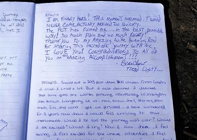
8/16/15 I am finally here! This moment that seemed it would never come, actually arrived too quickly. The PCT has ruined me…in the best possible way! So much pain, and so much beauty! Thank you to my amazing wife Hummingbird for sharing this incredible journey with me, I love you! Congratulations to all of you on this amazing accomplishment!!! Bearclaw, Tread Lightly…

Another thru-hiker came through. We congratulated him. He had us snap a photo or two, then he asked for the log book. Not sure what to write anyways, I handed it to him. He had pre-written a beautiful, well thought out piece on a separate piece of paper. Ripping two pieces of duct tape off of his trekking pole, he taped it into the logbook and snapped it shut. And then, he was gone, as if he had some pressing engagement to attend to in Manning Park.

“That would have been us in 2013,” I couldn’t help but think to myself as I watched him disappear. It took being snowed out and having had two years to mourn that loss, to learn from it, and to think about it, for me to fully understand and appreciate what being here truly meant to me. That was my path. Those had been my lessons to learn, and every one of those lessons had led me here, now.

08/16/15 – Snowed out in 2013 less than 400 miles from Canada, I cried. I cried a lot. But I also learned. I learned that some goals, are worth pursuing relentlessly. Washington has thrown everything at us – rain, snow, hail, storms, poor trails, fires, and wind – yet we persisted. I have wondered for two years now how I would feel arriving at this monument. Would I be sad the journey was over? Would I be excited? Would I cry? Now I am here, I feel strong. I feel excited for the next adventure. I feel gratitude for the experience, for the magic, for my trail family. I feel at peace. I love you Bearclaw. There is no one else I would have wanted to do this with. You are my rock. Krav, I love you, bro. Bearcat, wish you were here.


“We shall not cease from exploration
And the end of all our exploring
Will be to arrive where we started
And know the place for the first time” – T.S. Elliot.


Peace, Hummingbird

The story, of course, does not end here. For I was not at the end of all my exploring, I had simply come to end of another great adventure.

Armed with this knowledge, Krav, Bearclaw, Littlefeet and I left the monument and made our way into Canada.

It was eight miles from the monument to Manning Park. When we arrived, the parking lot was abuzz with tourists. Somewhere in there, dad and Marianne were waiting for us. Bearclaw turned off of the road to go find them.

“I’ll be right behind you,” I told him. “I have to do something first.”

“Have to do what?” Bearclaw asked.

I held up my phone with the Halfmile App.

“I have to finish the trail,” I responded.

Bearclaw followed me up the road. I watched as the Halfmile App counted down the final few steps. Where the road to Manning Park joined the Highway, my app hit all zeros, and I was left standing at the Official end of the trail.

Immensely satisfied, we turned around and headed back to the parking lot. Dad and Marianne were as excited for us as we were; giving us big congratulatory hugs. Together, the six of us got a cabin at the Manning Park resort and spent the afternoon celebrating.

Mile 2,625.28 to Castle Pass

Mile 2,625.28 to Castle Pass

Saturday, August 15, 2015
Day 15: Mile 2,625.28 to Castle Pass
Miles: 21.14
Total Miles: 2,646.42
Miles to Go: 12.48

Washington, I decided, was the gorgeous drama queen of States. It was beautiful to look at, but it was a giant pain in the ass.

We awoke to a dense, low hanging fog and temperatures in the low 40’s. The trees still dripped from last night’s rain.

“It’s like Washington wants us to leave the same way we entered, cold and wet,” Krav said from his tent.

When I went to answer him, I could see my breath. Burr, this was entirely too reminiscent of Washington 2013. I wouldn’t have been the least bit surprised if we saw snow before we hit Canada.

On the bright side, it had stopped raining, our tent was watertight, the rain had to have helped the fires, and we were only thirty-three miles from Canada!

I went to get out of the tent, only to discover I couldn’t stand up straight. I don’t know what I slept on, but my lower back was killing me.

“Bring it on Washington,” I thought. “You’ve already thrown rain, snow, fire, trail closures, and detours at us. Is a little back pain all you have left in your bag of tricks?”

Landslides? Tornados? On second thought, I didn’t want to know what else Washington had up her sleeve. I just wanted to get to Canada alive, and I was prepared to crawl there on my elbows if I had to.

Breakfast was a quick affair; it was far too cold to linger. Hefting my damp backpack on to my aching back, the best I could manage was a hunched over hobble. I downed a handful of Vitamin I and hoped for the best.

The good thing about a cold, misty morning was that—pain or no pain—you wanted to hike fast just to stay warm. That, and there were no spectacular views to distract you from doing anything but hiking.

Foggy Pass, was exactly that. Jim Pass was no better. Then down came the rain. We were we cold, we were wet, but we were happy. We were going to Canada, and there was nothing anyone could do to stop us.

Eventually, around Holman Pass, it stopped raining, and at the next small stream, we took the opportunity to eat lunch and filter water.

This was our last lunch together on the Pacific Crest Trail. From here on out, everything would be a “last.” Our last dinner on the trail, our last campsite, our last day. This was bittersweet. We were all looking forward to finally making it to Canada, and yet none of us wanted the trail to be over. None of us wanted the adventure to end.

“I wish Bearcat was here,” Krav said sadly.

“Yeah, me too,” Bearclaw sighed.

“Me three.” I chimed in.

There was a long silence. We missed Bearcat.

“Yeah, it sucks,” Krav said. “But then again, nothing sucks like an Electrolux.”

This was a pure Bearcat!

“Efficiency is key,” I added.

“ACCCHHHILLLLEEESS!!!!!!” Bearclaw roared, and then we burst out laughing.

The only thing that would have made finishing the trail better, we agreed, was if Bearcat had been able to join us so that we could finish as a family.

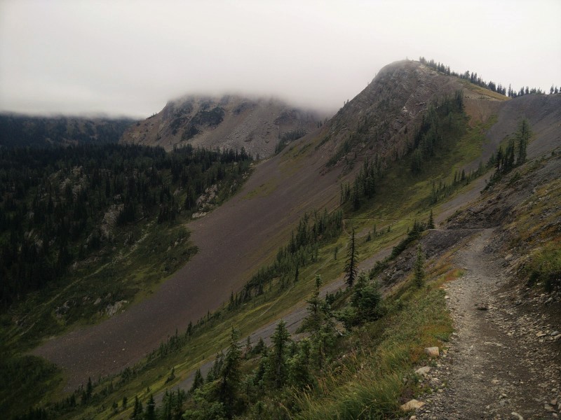
On and off, the fog lifted, revealing vast valleys and sweeping meadows and then we were cast back into the rain and dense fog.

Ten miles from the U.S. / Canada border we could see blue sky ahead.

“Looks like it’s sunny in B.C. at least,” Bearclaw said.

“Stupid rainy-ass bitch Washington,” I replied.

We unanimously agreed Washington had it in for us.

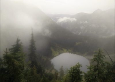
Near Devil’s Staircase, the fog lifted again, just enough to give us a clear view of Hopkin’s Lake nestled far below. Originally, we had wanted to make this our evening destination, but now we were driven to continue. We wanted to camp as close to Canada as we could.

Passed Hopkin’s Pass, we found a talus pile and sat down to make dinner. This was our last dinner together on the Pacific Crest Trail. The pikas must have sensed this, as they came out in droves and even allowed us to snap a few photos.

It was dusk when we arrived at Castle Pass. Off to the left of the trail was a big open campsite. Already, a tent was set up in the far corner. We were a little bummed to share our last campsite with a stranger, but it would have to do.

Our packs were wet; our tent was still wet. Krav’s down sleeping bag was damp on the side that had been facing the back of his backpack. Still, there was nothing Washington could do to rob us of our joy, of our sense of accomplishment.

Getting ready for bed, I heard a voice from the stranger’s tent.

“I know that voice!” I said to Bearclaw.

“What? Who do we know that it could it be?” Bearclaw said

“Littlefeet?” I called out.

I heard the stranger’s tent unzip.

“Hummingbird?”

We were not in the company of a stranger! We were in the company of a friend! We had met Littlefeet while doing trail magic near Bend earlier in the summer; he was hiking with our friend Hot Mess and her crew!

“Where is Hot Mess and everyone else?”

At the fire detour, the crew had split up. Some had obligations back home, some had opted to walk the detour, and others had opted to go to Lake Chelan. Littlefeet had ended up ahead of them all. After having hiked together for month’s he now faced the reality of arriving at the border alone. The trail provided, and no we could arrive together as friends and celebrate each other’s victories. I knew for him, it wouldn’t quite be the same – a trail family is a bond that cannot easily be forgotten – but at least it was something.

We cozied into our sleeping bags, for one last sleep on the PCT. We were only four miles from Canada.

Glacier Pass to Mile 2,625.28

Glacier Pass to Mile 2,625.28

Friday, August 14, 2014
Day 15: Glacier Pass to Mile 2,625.28
Miles: 15.63
Total Miles: 2,625.28
Miles to Go: 33.62

Sometime after dark, I was awoken by the snapping of branches. The air was thick with smoke. For a brief moment, my half-asleep brain thought the branch snapping was the crackling of fire. Eye’s wide open; I fully expected to see the glow of embers burning outside the tent.

But there was no glow, and the twig snapping was just a noisy deer, whose eye’s reflected like headlights in the beam of my headlamp. For the first time, it dawned on me that, in our haste to get to Canada, we had not so much as looked at the fire closure notice at Cutthroat. We hadn’t asked anyone if we would be safe. We had no idea if the fire closure was due to the fires we had seen burning behind us, or fires that lie ahead of us. We had heard from the section hikers we were camped with that there was possibly another fire burning closer to Hart’s Pass. We also didn’t have a map big enough to show our exits.

I wasn’t scared; I just felt stupid. How horrible would it be for my poor parents to get a call that I was missing and presumed dead in a burning forest?

No, I reasoned, the ranger wouldn’t have told us we could continue if the danger had been imminent. They would have flat out said no and sent helicopters to rescue anyone ahead on the trail. The only helicopters we had heard all day were obviously firefighting. Besides, we knew where all the lakes, rivers, and streams were; if the fire was close, we could always go to water.

Feeling better, I went back to sleep.

In the light of day, our situation seemed less dire. The smoke was only as thick as it had been the day before, and our pet deer was still wandering around the campsite. Surely he would be running for his life if he felt he was in danger, animals had good instincts.

Five miles up the trail, we rounded a corner to see the entire ridgeline of Tatie Peak on fire. Standing off to the side of the trail, was a wildland firefighter. He informed us that the fire was currently a half mile squared, and had already burned 160 acres of forest since yesterday. The trail was closed as far as Hart’s Pass.

We asked him if we should turn back, or continue forward. He assured us the trail ahead was safe to travel. Tatie Peak was rocky, and there wasn’t enough fuel to burn, so long as the winds didn’t pick up, the fire was unlikely to breach the mountaintop. Just be quick, and don’t linger, he had added.

Helicopters buzzed low overhead. We did as we were told, covering the five miles to Hart’s Pass without stopping.

Happy to be at Hart’s Pass, and out of danger, we decided it was time for lunch. As we walked through the parking lot, a ranger walked out of the little cabin.

“Were are guys headed?” He asked.

“Canada!” We replied giddily.

“I’m afraid your hike is over for the season. Trail’s closed all the way to Canada.”

Krav looked at Bearclaw, Bearclaw looked at me, I looked at Krav. My heart sunk. We were thirty-five miles from Canada. Just thirty-five miles. We were so close.

I wasn’t going to argue with the man; he was just doing his job. Washington was on fire; it wasn’t his fault.

“I need to go to the bathroom,” I mumbled to Bearclaw, and disappeared in the direction of the outhouse.

Bearclaw and Krav continued to talk to the ranger, while I fought back tears. We had tried so hard, only to be denied again.

“Pull yourself together H. Bird,” I thought. “This isn’t the end of the world.” But somehow, it felt like it was.

“We can go.” The boys smiled when I returned.

“What?” I asked confused. I mean, I’d only been gone like three minutes, and it had been a pretty solid “you’re done” when I’d left.

“He’s going to let us go. He hasn’t posted the signs yet, so he’s going to let us go, as long as we’re fast.”

“What about the fires?” I asked.

“There aren’t any fire’s ahead, there just aren’t any exits between here and Canada, so they’re closing the trail as a precaution, in case the fires to the south get out of control. Get your pack, let’s go!”

I grabbed my backpack, we gave the ranger an excited wave good-bye, and we flew down the trail. A mile later, we stopped for water at a seasonal creek and decided to finally eat lunch.

“How did you guys convince that guy to let us go?” I asked Bearclaw and Krav.

While I had been it the washroom, Bearclaw had told the ranger about our being snowed out in 2013 and that now we were trying to finish, but that he guessed it just wasn’t meant to be. The ranger had asked where we had started from yesterday. Bearclaw and Krav had told him we’d started just before noon at Rainy Pass. He did the math. In twenty-four hours, we had covered thirty-one miles. There were only thirty-five miles left to Canada. If we needed to, we could be in Canada by noon tomorrow. That was what had convinced him to let us go. That, and the technicality that the sign had not yet been posted.

By midafternoon, the entire sky had clouded over, and a cold wind blew. By the time we neared Tamarack Peak, it had started to rain. The rain put our minds at ease about the danger of fire, and the need for speed. We found a semi-sheltered campsite and threw up the tents.

As we scrounged for twigs and branches that would make sturdy enough peg with which to storm pitch his tent, poor Krav wished he had splurged on the tent pegs back in Winthrop. But how were we to know?

It hadn’t rained in months, and now here it was pouring down on the parched earth. Snug in our tents, we weren’t about to complain… We were going to Canada.

Rainey Pass to Glacier Pass

Rainey Pass to Glacier Pass

Thursday, August 13, 2015
Day 13: Rainey Pass to Glacier Pass
Miles: 21.02
Total Miles: 2,609.65
Miles to Go: 49.25

After breakfast dad and Marianne drove us up to the trailhead at Rainy Pass so we could make our final push north. On the drive up, we could see a new forest fire burning on one of the steep mountainsides to the east of the road. There was already a fire crew on it. Everything was so dry; I imagined every single lightning strike that had hit the forest during the storm had started yet another fire.

The plan was for Dad and Marianne to meet us at Manning Park in four days’ time. With half of Washington already on fire, they debated whether they would spend those days in the States, or back in Canada. With the new lightning strike fires we had passed on our way to the trailhead, they had decided to spend at least the day in the area, in case we got blocked by fire and were forced to turn around.

A few big hugs and “see-ya-soon’s,” and we were once again headed north. To get a flavor for the trail, dad and Marianne decided to take day hike south.

Maybe it was the smoke in the air, or maybe it was that we were only four days from Canada, but there was a definite sense of urgency as we made our way up towards Cutthroat Pass.

We arrived at the pass only five minutes behind Krav.

“The trail’s closed,” Krav said as we arrived.

“Dude, that’s not funny,” we responded.

“No, seriously,” he continued, “I was standing at the sign waiting for you guys when a ranger walked up and posted this.”

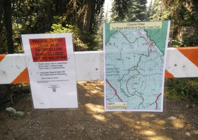
He pointed at a crisp white Fire Closure Notice.

“I asked him if that meant us too, and he told me that because I had made it past the sign before he posted the closure notice, technically we could continue. He just said, move fast.”

We had just squeaked by on a technicality, thanks to Krav’s fast pace. There was not one single second of hesitation. We had been denied once; we weren’t going to be denied again. We were going to Canada come hell or high water. We took a quick look over our shoulders and booked it past the sign and around the corner.

We were halfway to Granite Pass before we stopped to have lunch in the shade of a cliff face. From our lunch spot, we could see the billowing smoke plumes of two separate fires burning off of nearby mountainsides.

Where these the fires that had just closed the trail?

The fires were a safe distance away, but a steady breeze was blowing; we dared not sit for too long. Cramming the rest of our cheese and crackers in our mouths, we packed up, and we hiked hard and fast. Even with our late start, we made it over twenty-one miles by nightfall. We weren’t messing around.

Exhausted, and with throats raw from breathing smoke all day, we crawled into bed and went to sleep.

Mile 2,526.27 to Sedro Woolley

Mile 2,526.27 to Sedro Woolley

Monday, August 10, 2015
Day 10: Mile 2,526.27 to Sedro Woolley
Miles: 19.09
Total Miles: 2,538.35
Miles to Go: 120.55

We woke up at sunrise, only twelve miles from our detour off of the PCT. I had mixed feelings about this; I didn’t want to detour from the PCT, Washington had already robbed us of getting to Canada in 2013, and now it was robbing us of the North Cascade National Park section of the trail and a “proper” finish. That felt selfish, but I had been waiting to finish the trail and see the Northern Terminus of the PCT for two and a half long years now. The other part of me was excited to see my dad two days early. Now that we were missing two days of trail, that meant we could spend more time with him and his wife, Marianne.

While breakfast cooked, I wandered around camp trying to snap photos of the pikas (or “furry burritos” as Krav called them.) It turned out that trying to photograph a pika was nearly impossible. Two dozen photos and only three of them contained a pika.

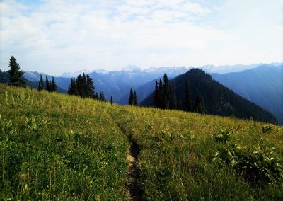
We were only a few miles into our morning when we came to a large grassy meadow at the base of a mountain. The trail curved all the way around it in a large arc, staying slightly higher than the meadow itself.

“There’s Krav,” Bearclaw said. Sure enough, Krav was way ahead of us, halfway around the arch.

“There’s a bear!” I said at virtually the same time.

“Where?” Bearclaw asked, excitedly.

I pointed to a large black dot roaming across the meadow below us.

“Krav!” We yelled. “Do you want to see a bear?!” But his headphones were in, and he was in his groove.

Bearclaw and I watched the bear as we circled the meadow. He was far enough away he didn’t pose a threat, and so we eventually stopped and watched him. Suddenly, movement caught my eye at the treeline on the far edge of the meadow. Another bear, this one with two cubs, had just stepped into the light. Four bears, in the same morning, in the same meadow!! We couldn’t believe it.

The mother and cubs weren’t in the meadow for more than a minute before she spotted the solitary bear, and she and the cubs turned and booked it back into the forest. All this trail action and Krav was missing it!

We watched the bear for a few more minutes and then left him in peace as we continued up the trail.

When we finally caught up to Krav at break and told him what we saw, he was understandably bummed. I tried to show him the photos I took, but tiny black dots aren’t that interesting. I wish I had a better camera!

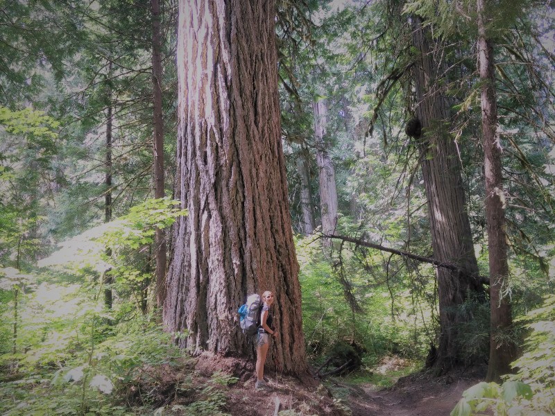
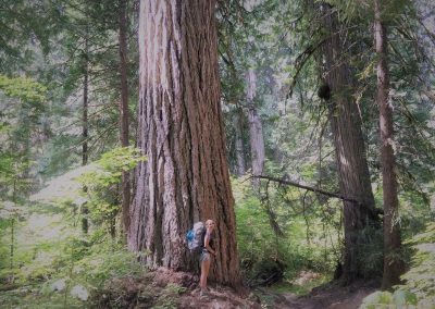
The closer we got to the Suittle River, the bigger the trees grew. Soon, we were enveloped in the fairy world of ancient giants. I love old trees. Standing beneath them gives me a sense of calm. A sense of oneness with the Universe. A sense of how small and insignificant I am in the grand scheme of things, and yet a feeling I am an integral part of something so much bigger than myself that I cannot possibly fathom it.

“Hello old friend,” I smiled, running my hand across the rough bark of a particularly large tree. And I meant it; this tree was much my friend as anyone I had ever know.

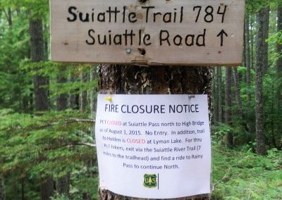
Crossing the long bridge over the Suittle River, the forest spell was broken. We had arrived at our detour; a large white “Fire Closure Notice” nailed to the tree beneath the junction sign. And just like that, we were once again off the Pacific Crest Trail.

The eight miles to the Suittle River trailhead were beautiful; waterfalls tumbled down baren rocks, the green mossy banks and logs thriving in the spray. But, it wasn’t the PCT.

We arrived at the trailhead at the same time as a couple that had been out for the weekend. They were headed back to Seattle. We explained our situation, and without hesitation, they offered us a ride.

“Where would you like to go?” The woman asked us, as we piled into their van.

“We’re headed to Rockport,” I responded.

“Oh, you guys don’t want to go to Rockport,” she answered back. “There’s nowhere to stay, and it’s super meth-y.”

We laughed, but she assured us she was not exaggerating.

I looked at my map for the next nearest town in the direction they were heading.

“How about Concrete?” I asked.

“Um,” she hesitated. “We’ll drive through town and let you decided. It’s pretty Meth-y too.”

The Main Street of Concrete, Washington was all of two blocks long and had the disheveled appearance of a town that had once been quaint and semi-thriving, but then the major employer (concrete?) had left town and now, it was just a handful of stragglers hanging on by a thread. Besides the Pub, not a whole lot appeared to be happening in downtown Concrete. The Confederate flags draped in the windows of the homes we passed, did nothing to add to the aesthetic.

“See,” our ride said. “Meth-y.”

They ended up leaving us at a hotel in Sedro Woolley, the first community they felt we’d be “safe” in. Thanking them profusely, we wished them the best.

I called dad and changed our location yet again, and he, in turn, once again changed his route to accommodate us. They would meet us at noon the following day, at the coffee shop across from our hotel.

Showered, clothes in the washing machine downstairs, we ordered pizza, and turned on the TV.