Mile 2,489.4 to Mile 2,508.10

Mile 2,489.4 to Mile 2,508.10

Saturday, August 8, 2015
Day 8: Mile 2,489.4 to Mile 2,508.10
Miles: 18.7
Total Miles: 2,508.10
Miles to Go: 150.81

We may have had a crappy night’s sleep in our cramped, uneven tree hole, but we awoke in an exceedingly good mood considering. With only one tent to pack up and a chill in the air, it did not take us long to get back on the trail.

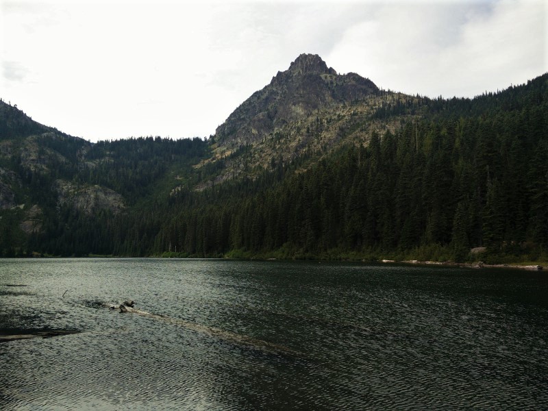
We arrived at Lake Sally Anne around breakfast time, to discover it was packed! With tents crammed into every available space, we all agreed that trying to find a campsite after dark would have been a nightmare. As we followed the PCT around the east side of the lake, we watched in disbelieve as dozens and dozens of campers emerged from seemingly nowhere to make breakfast, drink coffee, and get ready for another day in the backcountry. Suddenly, we were that much more gratefully for our solitary little hole in the gnarled trees.

Side trails crisscrossed and joined the PCT at random as we passed Ward’s Pass and Dishpan Gap. There were no roads marked on our maps, but from the number of hikers and trails, we assumed there must be some nearby.

It wasn’t hard to see why the area was so popular; everywhere we looked was postcard perfect and just when we thought it couldn’t get any better, it did.

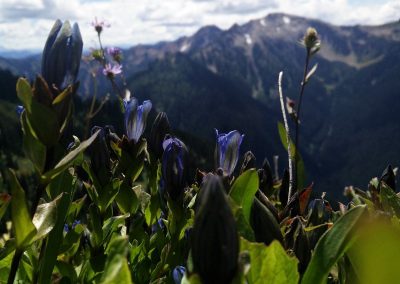
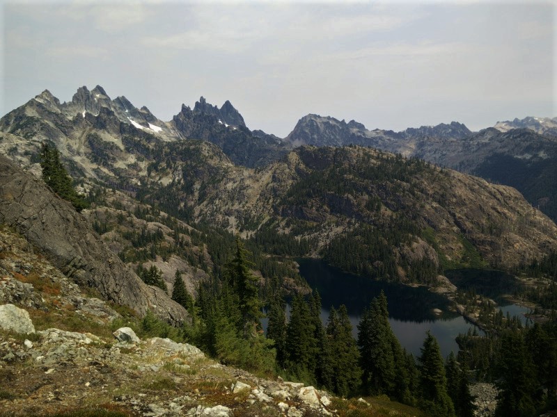
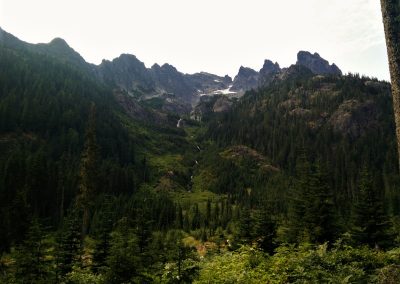
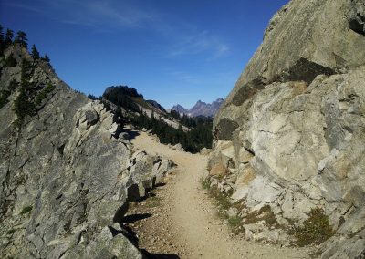
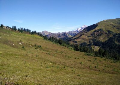
Coming over a gentle rise, we found ourselves entering the Glacier Peak Wilderness. In front of us, the trail sloped down through a giant meadow and disappeared into the thick pine forests at the base of Indian Head Peak. Beyond the grassy peak (which was sadly devoid of the glaciers marked on my map) a snowcapped Mount Baker teased us in the distance. Luckily, we would get to hike around Mount Baker, before we had to veer off of the trail for the fire closure.

We stopped at Indian Head Creek for a snack, and again a few miles up the trail to simply drink in the beauty that surrounded us.

My brother-in-law constantly hounded Bearclaw and me, “I don’t know why you guys always have to have a destination when you’re out in nature. Why not just sit on a rock for two or three hours and enjoy what’s in front of you, now.”

Though the determined and goal driven side of me balked at this (gotta’ make those miles yo), the rest of me had to agree; life was too short to pass all this beauty by.

As hard as I try, I have always found it difficult to be present, truly present. My mind is always thinking about the “what if’s” and the “should do’s” and the “wouldn’t it be cool if’s.” I have an excellent imagination, and I hate to say it but most of my time is spent a million miles from reality. Maybe, that’s why I liked hiking. It connected me to the present, even when my mind was far, far away.

We ate lunch near White Pass, lingering in the August sun.

From White Pass to Red Pass was hell for me, and for nearly two miles, I wished I truly was a million miles away, and not just in my head.

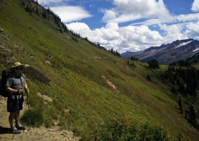
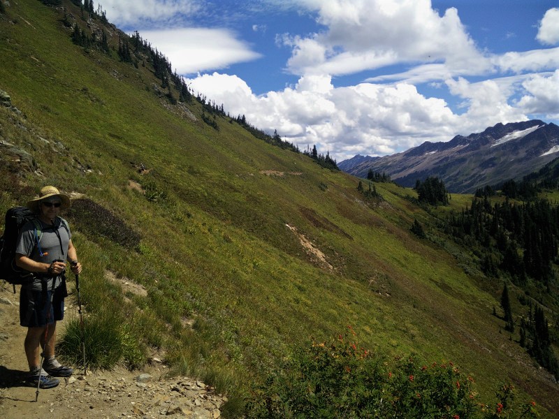
The trail gently climbed up the side of a mountain, through meadow and grass. There was nothing wrong with the trail itself, or with the views. The problem was me. There is an angle at which my vertigo goes into overdrive, and the mountainside we were walking on was at that angle.

The downhill side of the trail began to swim in my vision. The path was suddenly far too narrow. I felt nauseous. In my head, I was almost certainly going to fall off the mountain at any moment. My legs felt like Jell-O.

Hiking ahead, Krav was oblivious to my distress. Bearclaw however, was acutely aware of my “height” issues.

“Even if you did fall,” he assured me, “you would stop in like five feet. It’s not that steep here.”

Logically I knew this, but when I start feeling like this, my brain tells me I will spontaneously and without reason, fall, and I will not stop. I will just keep on falling and falling forever, into nothing.

“Oh no, really, I’m a badass hiker,” she said unconvincingly as she clutched her husband’s backpack and whimpered in fear of the big bad mountains. I mean seriously…

I’ve been slowly trying to come to terms with this fear/issue because it’s ridiculous (even to me.) I’m a grown ass woman.

“Want to hold onto my pack?” Bearclaw asked knowingly.

“No, I’m okay,” I mumbled, on the verge of tears. Every step was a fight with myself.

I am happy to report that I made it to the top of Red Pass on my own, with no help. I was fighting back tears and shaking like a leaf, but I made it and, unsurprisingly, I did not fall off the side of the trail and tumble all the way down to the bottom of the mountain on the way.

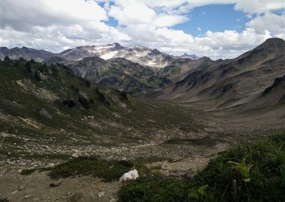
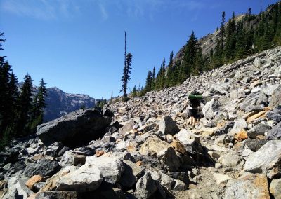
The view on the other side of Red Pass was worth every single scary step. Mouth open, I completely forgot how terrified I had been moments earlier. A broad, scree-strewn basin lazily curved around White Chuck Cinder Cone to our left and disappeared into the valley beyond. In front of us, stark, barren peaks rose in every direction. Off in the distance, the White Chuck Glacier sparkled in the mid-day sun.

This was worth a sit, and an attempt at being in the moment. We did not, however, sit for two or three hours, because, you know, miles.

Dropping into the basin, we were all in awe. Can you believe this place? Could this get any better?

Turning into the Chuck River Valley, the trail was all downhill as we entered back into the forest. Our goal had been to make it up and over the first of many big climbs by nightfall, but alas, we had stopped one too many times to take in the scenery.

We made camp next to the milky Baekos Creek. As we ate dinner, a couple through hiking the trail decided to join us in camp. She was Purple, on account of her purple hiking skirt. For the life of me, I cannot remember his name. Exhausted, we climbed into bed, where, instead of being present, I worried about how scary the next few passes would be, and whether or not I was up to the task.

Small Tarn to Deep Lake

Small Tarn to Deep Lake

Monday, August 3, 2015
Day 3: Small Tarn to Deep Lake
Miles: 14.76
Total Miles: 2,432.32
Miles to Go: 233.94

This morning was one of those mornings where I woke up and started by wiggling my toes, just to make sure my legs still worked. Upon discovering they did, I immediately gave thanks to the miraculous healing powers of the Mighty Vitamin I (Ibuprofen.)

Over breakfast, we quietly discussed our plan for the day, trying not to scare a doe and Bambi that had cautiously made their way down to the water for a drink. Everything was so incredibly dry that I felt bad for them. This little tarn was likely one of the only decent water sources for miles in any direction.

Since we’d hiked farther than planned yesterday (and it had almost done us in), we decided to make today shorter.

“How far did we wind up hiking yesterday anyway?” Bearclaw wanted to know.

“19.58 miles,” I responded.

“So, twenty.”

“Mmm, no, just 19.58.” I never round up our mileage, and it drives poor Bearclaw crazy!

“If it was 9:58 and someone asked you what time it was, would you tell them it was ten, or would you tell them it was 9:58?” Bearclaw asked in exasperation.

“I’d tell them it was ten.”

“Oh, I see how it is! It’s okay to round up time, but not our mileage?!” I smiled and nodded as he laughed and shook his head.

“Deep Lake is in 14.76, or fifteen miles if you prefer,” I suggested. “That’s short enough that we might even get to camp in time for a swim.”

This idea was met with a round of approval, and so, we packed up and hit the trail.

“I’m so glad we pushed ourselves last night. I would not want to have to start today with that climb.” Krav said as we made our way up the last hundred or so feet of elevation gain. My legs wholeheartedly agreed.

I was even more glad we hadn’t pushed ourselves another mile up the trail to the “campsites near small lakes” that were listed on our maps. Because, this morning, as we got near to the lakes, we were greeted not only by a “no camping within one mile of lakes” sign, but the lakes themselves were almost completely dry. That would’ve been an epic letdown.

Though there was the occasional grand vista or milky green river coursing through sheer-sided canyons, the majority of the day was spent hiking through forests. Compared to yesterday, the scenery was relatively boring.

Near the bottom of the long descent into the Waptus River Valley, we ran into a group of eight backpackers.

“Are you guy’s thru-hikers?” They asked.

I could see Bearclaw and Krav smile. More than once over the last few days, they’d sadly commented on how no one has asked us if we are thru-hikers. I had a feeling it had something to do with the two inches of “extra padding” bulging out from above and below our hip belts. Or maybe the fact that our tongues practically lick the dirt as we slowly pant our way up the hills. We were in Washington. At this point in the game, all the thru-hikers were as lean, muscular, hairy, and fast as the elusive Sasquatch. In fact, ninety-nine percent of the Sasquatch videos on YouTube are probably just misidentified Washington thru-hikers. It would be an easy mistake to make.

We lunched alongside the Waptus River, congratulating ourselves on hiking eight miles by eleven o’clock. It took us nearly twice as long to hike the remaining six miles. We were in no rush, and the forest was hot and muggy.

A few miles up the trail, we sat down on a log and watched two lean, dirty hikers cruise up the trail as if it were flat. Now, these guys were thru-hikers! Enter Eastbound and Caesar.

“It’s the Cascadia family!” Caesar laughed, staring at all of our Cascadia clad feet. “We’ve been following your prints ever since the Waptus!”

This led to a hilariously detailed discussion about the last four seasons of Brooks Cascadia trail runners. It was agreed that the 7’s were the perfect shoe while the 8’s were a close second. The 9’s fit well but always seemed to tear in the same place after about two hundred miles, and the 10’s were just total crap.

“I know, I tried a pair of 10’s on a few weeks ago, and they’re definitely narrower in the toe box. I’m seriously considering writing Brooks a letter. They need to bring back the 7’s.”

I know what you’re thinking because I was thinking it too.

“Really Hummingbird? You’re going to write a letter? About shoes? Wow, that is totally lame.” But I couldn’t help myself – I friggin loved the 7’s, and Brooks has been slowly breaking my heart with every pair they’ve released since.

Eastbound and Caesar also had bad news regarding the Blankenship and Wolverine Fires that were burning in the next section of trail. Apparently not only were thirteen miles of trail closed, but the detour around the closure was also now closed. If we had to skip all of Section K, I was going to tell Washington where to go and how to get there. Section K represented a hundred and twenty-four of the two hundred and eighty miles of trail we had left. Sometimes, I think Washington really didn’t want us to finish the PCT.

As quickly as they’d cruised up, Eastbound and Caesar were gone.

We stopped and chatted with a wiry man in his late forties, whose calves were the size of tree trunks and whose backpack rivaled his person in both weight and height. He casually mentioned that he’d weighed it before he’d left home and proudly declared that it weighed seventy-three pounds. He went on to tell us we would almost certainly run into his wife, daughters, nephews, and lastly his brother who, “wasn’t really into this kind of thing.” As he happily skipped off down the trail as if he were weightless, I secretly wondered if his pack was magic.

Sure enough, one by one, we met the rest of the family. Some of them seemed more excited than others to be out in nature. As predicted, his brother and two young nephews were bringing up the rear. Is it just me, or is “bringing up the rear” an odd idiom? Huh.

We set up camp along the creek next to Deep Lake, and while Krav and Bearclaw napped what was left of the afternoon away, I explored the creek and chased frogs.

Just before sunset, I conned Bearclaw into checking out the lake with me by convincing him it would only be three-hundred steps up the trail. It was actually three-hundred and ten to the shoreline, not that I was counting.

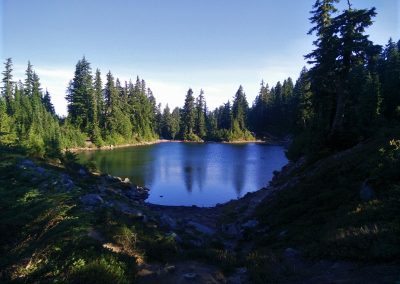
Our short hike turned up a pretty alpine lake, a super friendly Californian backpacker, and an eccentric pair of section hiking pirates, proudly flying a massive Jolly Roger over their camp.

Some days what the trail lacked in beauty, it made up for in friendly, interesting people.

Ridge Lake to Small Tarn Mile 2,417.56

Ridge Lake to Small Tarn Mile 2,417.56

Sunday, August 2, 2015
Day 2: Ridge Lake to Small Tarn Mile 2,417.56
Miles: 19.58
Total Mile: 2417.56
Miles to Go: 248.67

“TIME TO GET UP!” Krav yelled from his tent. It was 6:00 a.m.

I’d totally forgotten about the Krav alarm! I rolled over and popped out of the tent, pleasantly surprised my feet, calves, and hips had made a more-or-less full recovery.

I sat down cross-legged on a bare piece of ground and started to make breakfast. To my right, the mountains the trail would be contouring around were awash in the soft peach glow of the early morning sun. To my left, in typical hikertrash style, Krav was making himself breakfast from bed. Behind him, a pika scampered up a large half-moon shaped boulder in the talus field and greeted the new day with a piercing “PEEP!”

Oh, my God, a pika! I’m of the opinion there is no cuter animal in the forests of the Northwest. Hell, even marmots are homely in comparison! (Sorry, marmots, I still love you, but we both know it’s true.)

Although the American Pika was denied federal endangered species status in 2010, their populations are dwindling. Because pikas’ habitat is limited exclusively to rocky talus fields in high mountain ecosystems, they’ve adapted to a very specific set of living conditions. The excessive heat and mild winters brought on by global warming have been lethal to pika populations across the Northwest. I felt lucky just to be seeing this little guy.

“There’s a pika!” I whispered to Bearclaw and Krav.

“Ha! It looks like a furry burrito with legs.” Krav laughed when he finally spotted it.

Abandoning breakfast, I grabbed my camera and every so slowly tiptoed towards the rock pile. I made it three steps before the pika let out one loud warning “peep” to all his little pika friends and disappeared beneath a rock. Even though I’ve gone from trying to pet every animal I see, to simply trying to sneak up and photograph them, my ongoing attempt to integrate myself into the wildlife population has thus far been a monumental failure. Wildlife: 10,482 Hummingbird: 0.

Passed Ridge Lake, the trail clung precariously to the steep wildflower filled mountainsides of the Chikamin Range. With every turn, new views of pristine alpine lakes nestled in dark green forests, and valleys that seemed to go on forever, spread out before us. Joe Lake especially caught my eye. If I’d have known yesterday how spectacular it was, I would’ve hiked the extra two miles past Ridge Lake and camped there instead! Within the first three miles of trail, Bearclaw and I had stopped to take so many pictures that Krav was nowhere in sight.

I’ve always found it interesting how all-encompassing the phrase, “Hike Your Own Hike” really is— from gear and clothing preferences, to how you interpret and choose to apply LNT principles, to the simple act of how you walk a trail. Hiking is one of those things that there is no “one way” to do. You can ask a thousand people how they hike, and you will get a thousand answers. Take for instant Krav, Krav knows he is at his best when it’s cool. In the morning, he gets on the trail, and he is gone within minutes. You can’t catch him, very few people could. The hotter it gets, the slower he becomes. His solution is to “kill” as many miles as he can, as quickly as he can. On the other hand, Bearclaw and I are slow and steady all day long. At some point around noon, we catch up to Krav for lunch, and for hours after that, we will be ahead of him. As soon as it cools off in the evening, he’ll blow by us again, and we won’t see him until camp. Besides the fact that we beat him to camp, today was no different.

When Bearclaw and I stopped for a morning break on a low saddle above the Park Lakes, we asked a German hiker heading in the opposite direction if he’d seen Krav.

“Yes, I saw a man that fits that description about twenty minutes ago. He was going quite fast.” Yup that would be Krav!

Even though Bearclaw and I picked up speed as we headed down the tight switchbacks leading around the edge of the stunning Spectacle Lake, it was nearly one o’clock when we finally caught up to Krav, cooling off in a pool halfway up Delate Creek Falls.

“It’s warm!” He assured us, as we crossed the footbridge below the falls.

I had my doubts, but it was hot enough that dropping my pack and splashing around in the shallow pools of a picture perfect waterfall sounded incredibly inviting. Hours passed before we reluctantly pulled ourselves away from the creek and continued up the trail. No one was looking forward to the 2,200-foot climb that would end our day. The trouble was this: we either had a fourteen-mile day with no climb at the end, or we hiked a twenty-mile day to the next available campsite at the top of the climb. There was nothing in between. At breakfast, we’d decided to go big.

At mile 13.9, the campsite at mile fourteen was starting to sound mighty tempting. However, when we arrived, the decision was made for us— a father/ son section hiker duo, Tin Man and Crawfish, had already set up camp there. Twenty miles it was.

Knowing we’d be so exhausted by the time we made camp that the simple task of setting up the tent would feel as complicated as disarming a ticking time bomb, we stopped at the last water source near the base of the climb for dinner.

“Are you ready for this?” Bearclaw asked as we packed up to leave.

I did a quick inventory. My ankles, feet, and hips were killing me, but that meant they still had feeling, which meant I was still alive, so that was a good start. I was exhausted. How we consistently did twenty-five mile days on the trail was a mystery.

“Nope, but let’s do this,” I replied.

“All you have to do is keep putting one foot in front of the other,” I told myself as we headed up the trail. I used the waterfall thundering off the glaciers of Lemah Peak on the far side of the valley as a measuring stick.

Every few switchbacks, I would come to grinding halt to see how much progress we’d made. Ever so slowly, “We’re almost halfway up the falls,” turned into, “We’re at the top of the falls,” turned into, “Yay, now we’re in line with the lower glacier.” Things were going fine until, half a mile from camp, I was reunited with my nemesis the fallen log. This particular log was one of those logs that was impossible to go around, impossible to climb under, and just the wrong height for easily going over.

“Oh hello, exhausted little Hummingbird….Did you miss me? Muhahahaha!”

Stupid, log.

Painstakingly lifting one leg over, I lay there like a cheetah hanging out on a tree limb, both legs and arms dangling over the sides, a good six inches off the ground.

“I’m stuck,” I mumbled to Bearclaw, my face smashed up against the bark, “Can you push me?”

He reached out and gingerly gave me nudge until I slid like Jell-O off the far side.

“Great, now how am I going to get over?” He looked as exhausted as I felt.

“Just swing your leg over, and I’ll pull you.” I offered pathetically.

Accepting this as a viable solution, he swung his leg over the log. I tugged on his backpack until he too slid over, and we both found ourselves on the winning side.

The log defeated; we stumbled into a sandy campsite tucked alongside a shallow tarn just in time to watch the sun set behind Lemah Peak. The last of the light hadn’t even faded from the horizon before we were fast asleep.

Snoqualmie Pass to Ridge Lake

Snoqualmie Pass to Ridge Lake

Saturday, August 1, 2015
Day 1: Snoqualmie Pass to Ridge Lake
Miles: 7.48
Total Miles: 2,397.98
Miles to Go: 268.25

“Are you guys excited?” My friend Tree asked as she drove us up to Snoqualmie Pass from her parent’s house in Ellensburg.

Truthfully, I was exhausted and stressed. Two nights of little-to-no sleep and I was a barely functioning human being. Mentally, I was still at work. Did I remember to send out that last email to let everyone know I had no intentions of working for the next three weeks? What if there was a catastrophic failure in a client’s auto-campaign while I was gone that brought down Facebook and society as we knew it? Ha! Who was I kidding, I didn’t even remotely have that kind of power! Most days I congratulated myself just for being at my desk by eight with my underwear on the inside of my pants. Still, I didn’t even have my laptop with me. I felt naked and vulnerable.

I was also nervous. Could we hike eighteen miles a day? Our “training” had involved two weekend backpack trips and three whole visits to the gym, where I’d spent thirty minutes pretending I remembered how to swim laps. Next to the lane of Master’s Swim Club members torpedoing across the length of the pool, I’d had all the grace and stamina of a giraffe caught up in a flash flood. Oh well, as Bearclaw liked to say, “Nothing gets you in shape for backing, except backpacking.”

Speaking of backpacking, I’d packed our backpacks in less than an hour because there just hadn’t been enough time. I hoped I hadn’t forgotten something important. During the entire drive to Ellensburg, I’d been going over it in my mind. Tent? Check. Sleeping bags? Check. Sleeping pads? Check. When I got to the end of the list, I would start all over again. I was driving myself insane. What I needed was to disconnect, to decompress.

And then, it dawned on me; we were headed back to the trail! In less than an hour, we would be at home in nature, and virtually nothing I was currently stressed about would matter. My entire life was about to be pared back to the essentials – food, water, shelter. The trail was about to kick my ass in the best possible way and remind me what was really important.

“Where are you supposed to be meeting your friend Krav?” Tree asked as she pulled into the parking lot of the only gas station in town.

“Just look for a tall skinny guy with dark hair and no beard,” I responded. Krav had started a week before us, picking up at the Snowgrass trailhead where snow had forced us to get off the trail in 2013. As Bearclaw and I had already hiked that section last summer, we’d told him we would meet him in Snoqualmie.

Snoqualmie Pass was a blink-and-you’ll-miss-it village; there were only a few places he could be. My bet was he was at one of the only three eateries in town. What would it be like hiking with Krav after so much time had passed? Was he the same guy? How much had he changed? How long would it take him to be like, “Oh my God, I hiked with these people for how many months?”

We found him sitting at the thru-hiker table at the Aardvark. He walked over and gave us a huge hug. His once jet-black hair was now a deep shade of chestnut brown, but other than that, he appeared to be the same old Krav.

As Krav unpackaged his Snoqualmie resupply box, he filled Bearclaw and me in on the last hundred and twenty miles he’d hiked.

“Two nights ago, I was listening to some music while setting up my tent in the dark when I started to feel like I wasn’t alone. I looked left, nothing. Looked right, nothing. Looked back to the left and all I could see in the light of my headlamp were a cougar’s head and eyes. He was just staring at me.”

“Really? Crazy… What did you do?”

“Dove into my tent and started yelling until it went away.” Krav smiled. God, how I’d missed this guy!

“It’s too bad Bearcat couldn’t be here.” He sighed. We all agreed.

By the time Krav had eaten brunch and was packed up and ready to go, it was early afternoon. We pulled out the maps, decided that if we could make it eight miles to the top of the climb out of Snoqualmie, we would be doing good, and hit the trail.

“Where is the trail from here anyway?” Bearclaw asked as we headed down the side of the highway.

I pulled out my Halfmile App.

“We are at PCT mile 2,390.64,” I responded giddily.

“You’ve missed that, haven’t you?” Bearclaw smiled, shaking his head in amusement at the obvious joy I was getting from consulting my GPS.

Had I ever! But not for reasons you, or he, might think. My love of maps and miles had nothing to do with my anal retentive need to keep us on schedule, or even a desire to know where I was. It was deeper than that. In front of me, two hundred and seventy miles of trail lay at my feet. Behind me, the trail stretched out over horizon-after-distant-horizon, all the way to Mexico. With that knowledge, came a great sense of freedom.

On weekends, when we hiked out-and-backs and loops, there were always a finite number of miles, a foreseeable end. This loop was sixteen miles; that loop was twenty. We always ended up precisely where we started, right back at the car. Not on a long trail, not on the PCT. On the PCT, we could hike for months and never reach our destination, and even if we did, we could always just turn around and hike back. There was absolutely nothing stopping me but my own fear and insecurities. Oh, and inevitably running out of money. For some reason, this thought put me in a complete state of Zen.

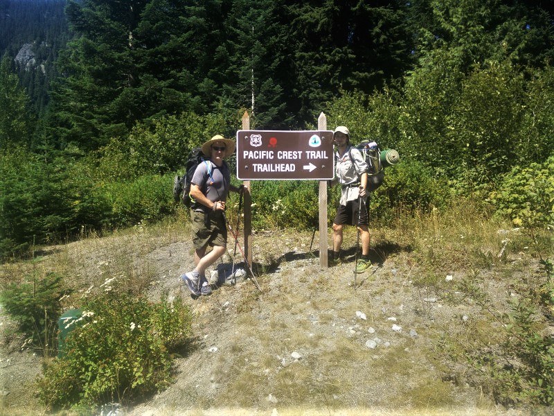
At the trailhead sign where the PCT diverged from the highway, we stopped for a few quick, “We’re back!” photos before excitedly ducking into the forest. We were back on the PCT!

The excitement wore off approximately three switchbacks in when my calves and thighs began to burn. We needed to gain 2,40O feet of elevation over the next seven miles? Ughhh… I probably should have made time for a fourth trip to the gym.

“We must have gone at least a mile and gained five hundred feet.” I thought, stopping to catch my breath and consult Halfmile. Or, you know, just a third of a mile and two hundred feet. This was going to be a long, slow, painful, ass-kicking.

A few miles in, the trail entered a talus-filled clearing, where I happily stopped to snap photos of a snowcapped Mount Saint Helen’s trying hard to still be visible through the smoky haze.

“You guys picked the hottest time of the day to climb this mountain, didn’t you?” A girl with long dreadlocks smiled happily as she and a friend breezed by us on their way back to town.

Fond memories of hellishly hot climbs out of Wrightwood, Cajon Pass, Castle Crag, Belden, Sierra City, Saied Valley, and Crater Lake, came flooding back to me. We did seem to have an uncanny knack for waiting until the hottest part of the day to climb. Were we sadists or did we just like getting sweaty and stinky? I’d already caught a whiff of my armpits, and I was well on my way to sporting a scent I like to refer to as “Eau du Hikertrash.” I am such a classy lady.

“Yeah, we have a tendency to do this kind of thing a lot.” I sighed.

As they passed by, I tried to spare their nostrils by keeping my elbows glued to my sides. I looked like a T-Rex, holding trekking poles.

Nearly to the top of the climb, I sadly realized that even though we’d been hiking for hours, I’d barely paid any attention to the trail. Instead, I’d been making a list of things I needed to do when I got back to work and prioritizing it for efficiency. No matter how hard I tried to turn it off, I couldn’t. It was as if the constant buzz of the I-90, echoing off the steep mountains around us, was tethering me to reality.

Eventually, the trail leveled out as it wrapped around a smooth rock ledge, passed over a short ridge, and promptly ducked behind a thick rock shelf. Just like that, the persistent din of traffic speeding towards Seattle, and all my anxiety was gone. I was officially on the trail.

“Do you hear that?” I asked Bearclaw.

“Hear what?” He asked, pausing a moment to listen.

“Silence,” I responded, closing my eyes and reveling in it.

We finally arrived at Ridge Lake around six, shocked to discover there were already fifty or so tents crammed into every campsite available. Every side trail we went up led to another tent. It took a lot of searching, but we finally found the last spot: a meadowy patch of grass, just big enough for two tents, hanging high above the serene lake.

Using the last bit of energy we had, we made our way down to the lakeshore for water. The lake was easily two feet lower than normal. Working our way through a muddy flat, we made our way to the rocks that lined the far side of the lake.

“Be careful when you waddle over here that you don’t fall in the lake Hummingbird,” Krav advised as he watched me work my way towards the spot he and Bearclaw had found to sit and filter water.

“Waddle? Did you just say waddle?” I asked indignantly. “That doesn’t have very nice connotations you know…”

“Well, you do kind of waddle.” He replied with a cocky grin.

Aww, I preferred to think of it as more of an ‘out-of-shape hiker shuffle.’

“Hey man, I am a Hummingbird, not a Penguin.” If I hadn’t used what little energy I’d had to waddle down to the lake to get water, I would have gone the extra four feet and pushed him in. But as it was, my hips and my feet were too sore. So instead, I filled up my Camelback and waddled back up the hill to bed.

Yosemite: Day One & Two

Yosemite: Day One & Two

Day One

We were in Yosemite; this was exciting for two reasons. One, I had never been to Yosemite. Two, we had read that Yosemite had seven hundred and fifty miles of trails, and we had every intention of using at least forty of them.

Our goal had been to arrive in Yosemite month’s earlier to backpack with our good friend and backpacking Guru Captain Analogy. But in our bliss of finally traveling with no set-in-stone plans, we had become sidetracked and waylaid in route. It was now mid-September, Captain Analogy was long gone, and we had finally just arrived.

We set up camp in the Porcupine Flats Campground and had been there for all of five minutes when our camp neighbor Wayne wandered in to say “hello.” Wayne was a philosopher, a poet, and an ultralight, long-distance hiker who I felt was lying when he insisted he was seventy years old. If Wayne was seventy, I weighed a hundred and ten pounds (psst…I don’t weight a hundred and ten pounds.)

Within minutes of introducing himself, he had a plethora of National Geographic hiking maps sprawled across our picnic table, showing us his favorite hikes, and planning Carl and my next backpack. It was simple, twenty-one miles up the John Muir portion of the Pacific Crest Trail, over Donohue Pass and into the Ansel Adams Wilderness to Thousand Islands Lake. From there we could either turn around or we could make a loop by hiking over to Gem Lake, up and over Koip Pass and back into the Yosemite Valley. If we decided to make the circuit, he recommended checking trail conditions with a ranger as he had never done that section of trail. Well, that settled that; we hadn’t even been in the park for an hour, and we already had a plan. Wayne insisted we keep his map, “just in case we needed it.”

At ten o’clock the following morning, we were at the Permit Office.

“How is the Koip Pass Trail? Is it easy? Hard?” Carl asked.

“I don’t know your fitness level. For liability reasons, I can’t really say. I can, however, tell you it is a popular trail.”

“Well,” we reasoned, “if it was a popular trail that meant it was well traveled; if it was well traveled, that had to mean it was well maintained.” What could possibly be wrong with that logic?

“Does the shuttle still run between trailheads, or is it too late in the season? Can we leave our motorcycle at one end?” Carl asked, working out the logistics.

“No shuttles, you can leave your bike or just hitchhike.”

“Where do we leave the bear canisters at night?” I asked. We had never hiked anywhere with a “bear can” rule before.

“About a hundred feet from your tent should do. You want it to be close enough that you can hear the bear if it starts messing with it, that way you can provide negative reinforcement by throwing rocks and pinecones at him.”

Wait, what? Had she just said she wanted us to throw rocks…at a bear…in the middle of the night? Does anyone else find it odd that the Rangers couldn’t, for liability reasons, suggest or describe a hiking trail, but yet they could recommend hitchhiking and throwing rocks and pinecones at an animal that could take your head off with one bite? As a society, we had dug ourselves into a very bizarre hole.

Hefting the rented bear canister off the counter, we made our way out of the office.

“Did she just tell us to throw rocks and pinecones at a friggin’ bear?” Carl asked when we were in the parking lot and out of earshot.

Well, at least I hadn’t been the only one thinking, “W.T.A.F!?”

Day Two

We had the best intentions of getting to the trail at the ass-crack of dawn, but by the time we said goodbye to our chatty new friend Wayne and dropped our “shuttle vehicle” (Carl’s little motorbike) off at the end of the trail, it was well past noon.

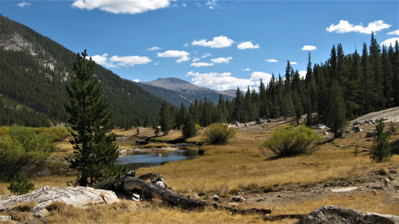
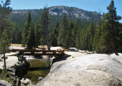
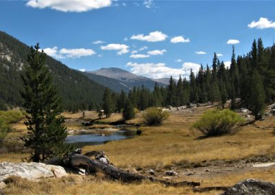
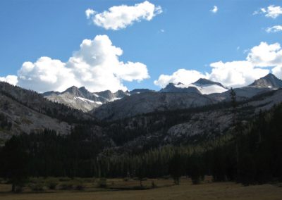
Starting at the Lyell Canyon Trailhead behind the Tuolumne Meadows Wilderness Center, our trail led through forest and meadow, over sparkling white granite and across a short wooden bridge. Soon we found ourselves hugging the side of a long meadow, tucked in the valley between two towering peaks. The Lyell Fork of the Tuolumne River meandered slowly through the gilded grass.

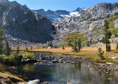
It was fall, and although the morning air was crisp, the ambient midday temperature was perfect for hiking. The contrast of the bare white granite enveloped in golden aspen leaves contrasted brilliantly against the crisp blue sky. This was the stunning backdrop as we worked our way deep into the Yosemite backcountry. We were in heaven.

In no rush, we spent our first night at the edge of an alpine meadow, just before the trail started to climb up Donohue Pass.